DU study finds worsening droughts, groundwater depletion in Rajshahi division
DU study finds worsening droughts, groundwater depletion in Rajshahi division
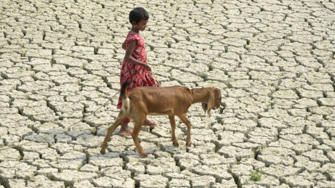
A 35-year study by researchers at the University of Dhaka has found a steady increase in agricultural, meteorological and hydrological droughts, alongside severe groundwater depletion across Rajshahi division between 1989 and 2023.
The findings raise concerns over food production and water security in the country’s major agricultural hub, where around 60% of the population depends on agriculture for employment and nearly 80% of the land is under cultivation.
According to the study, areas with shallow groundwater levels of less than five metres shrank from 47% of the division’s total area in 1989 to just 0.7% in 2023.
Meanwhile, areas with groundwater depths of 10 to 15 metres expanded from 0.18% to 24.99% over the same period, indicating a significant decline in groundwater availability.
The study also found that areas free from hydrological drought declined from 71.45% to 6.04%, while areas experiencing moderate to extreme hydrological drought increased from 0.46% to 31.64%.
Based on the combined patterns of agricultural, meteorological and hydrological drought, the researchers classified the division’s eight districts into three preliminary drought-risk categories.
Naogaon and Chapainawabganj were placed in the ‘Very High’ risk category because of extreme meteorological and agricultural drought conditions, alongside critical groundwater depletion exceeding 10 metres.
Sirajganj, Joypurhat and Bogura were classified as ‘High’ risk due to severe drying, agricultural stress and declining groundwater levels.
Rajshahi, Pabna and Natore were placed in the ‘Moderate’ risk category, with comparatively more stable, although declining, groundwater levels.
The researchers also found a sharp decline in drought-free agricultural land. Across five agricultural drought indices, the average proportion of drought-free land fell from 72% in 1989 to 44% in 1994, 30% in 1999, 16% in 2004 and 10% in 2009, before declining further to 8% in 2023.
Conversely, moderate agricultural drought expanded from 3% of the division’s area in 1989 to 42% in 2023.
Identifying the period after 2004 as a critical turning point, the study highlighted 1994, 2004, 2014 and 2023 as major drought years. The November-to-March dry season, particularly February and March, consistently emerged as the period of greatest vegetation and soil-moisture stress.
In 2023, the Vegetation Condition Index identified severe agricultural drought across approximately 7.57% of the division, particularly in Naogaon, Sirajganj, Bogura and Chapainawabganj.
The Temperature Condition Index, meanwhile, recorded moderate drought conditions across 56% of the region, reflecting widespread thermal stress.
Meteorological assessments also showed that moderately dry areas expanded from around 8% in 1989 to 47% in 2023. The Standardized Precipitation Evapotranspiration Index identified an extreme-drought hotspot covering up to 5% of the study area in Chapainawabganj in 2023.
The researchers noted that this coincided with a strong El Niño episode and increased evaporative demand, although the connection was based on previous literature rather than direct testing of El Niño-Southern Oscillation (ENSO) indices.
Satellite-based soil-moisture assessments identified eastern Chapainawabganj, Naogaon, Sirajganj and Joypurhat as long-term drought hotspots. A field survey conducted from 12 to 14 December 2024 also found a moderate-to-strong inverse correlation between measured soil moisture and satellite-derived dryness data.
The research was conducted by seven researchers from the Geoinformatics Lab of Dhaka University’s Department of Geology: Md Mehedi Hasan, Md Mahfuzur Rahman Khan, Md Golam Latif, Zuana Alam, Sadman Hasan Rafi, Md Nahid Al-Montakim and corresponding author Md Bodruddoza Mia.
Published online in September 2026 in the Elsevier journal Sustainable Geosciences: People, Planet and Prosperity, the study received funding from Dhaka University and the University Grants Commission for the 2024-25 academic session.
Using Google Earth Engine, the team analysed satellite imagery from Landsat and MODIS, precipitation records from CHIRPS, climate datasets and weekly groundwater observations from around 218 Bangladesh Water Development Board wells across nine drought indices.
However, the researchers cautioned that the district-level risk classifications were preliminary and focused on physical drought conditions without incorporating socioeconomic factors. They also noted limitations in the statistical assessment of long-term trends and the use of resampled meteorological data.
The study recommended shifting from reactive drought responses towards integrated water management, supporting the United Nations Sustainable Development Goals on food security, clean water and climate action.
Among the proposed measures were crop diversification towards lower-water-demand pulses and spices in high-risk areas, alternate wetting and drying irrigation, conservation agriculture, rainwater harvesting and aquifer recharge, subject to independent feasibility assessments.
Speaking to BSS, Dhaka University Geology Department Chairman Professor Md Bodruddoza Mia, who was also involved in the research, said drought conditions in Rajshahi division had intensified since 2004, with groundwater depletion emerging as a major warning sign.
“Drought in the Rajshahi Division has intensified since 2004, and the biggest warning sign is underground: land with the water table 10 to 15 metres deep grew from under 1% to about 25% by 2023. Chapai-Nawabganj and Naogaon are the most persistent hotspots of drought,” he said.
“We recommend integrated water management, with options like crop diversification and aquifer recharge evaluated for feasibility first,” he added.