Fort without a name: The unsolved story of Sahebganj’s ruins
In Sahebganj, a mysterious structure stretches across the landscape — part home, part ruin, part unanswered question about Bangladesh’s colonial past
Fort without a name: The unsolved story of Sahebganj’s ruins
In Sahebganj, a mysterious structure stretches across the landscape — part home, part ruin, part unanswered question about Bangladesh’s colonial past
Walking along a narrow road beside Shahebgonj Secondary School in Sahebganj village, in Faridganj upazila of Chandpur, surrounded by green fields and village homes, an old brick wall catches the eye. At first, it looks small and easy to miss. Then it stretches ahead, breaks, and rises again in parts.
“People don’t pay much attention to it,” said Md Saiful Islam, a 52-year-old resident of the village. “It has always been like this.”
A few steps ahead, the wall does not seem to end. It runs past houses, disappears behind bushes, and then appears again in another form. There is no clear boundary or entrance. It is simply there, woven into everyday life.
“There is more inside,” Saiful adds, gesturing ahead. “Go and see. No problem.”
What lies beyond is unexpected.
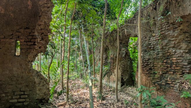
Then the area opens up. A tall structure comes into view, almost like a four-storey building. Around it are broken walls, long rows of collapsed rooms, and scattered bricks spread across the land. Small ponds sit among the ruins, their still water reflecting what remains.
“We used to come here when we were children,” Saiful said. “We climbed it. No one stopped us. No one explained anything.”
Right beside the ruins, life continues as usual. Homes are built against old walls. Kitchens occupy what appear to be parts of former structures. For those who live here, the ruins are not extraordinary.
“This is normal for us,” he said. “We grew up with it.”
In Chandpur, such coexistence with the past is not unusual. Shaped by the Meghna, Padma, and Dakatia rivers, the district has long been part of river-based trade and movement. Structures were built, used, abandoned, and slowly absorbed into the shifting geography of the delta.
Yet something about this site feels different.
“Some say the British built it. Some say the Portuguese,” Saiful explained. “Others say something else. We don’t know.”

Spread across what locals estimate to be several hundred acres, the ruins include thick defensive walls, a watchtower-like structure, long corridors, and clusters of rooms.
It looks like a fort, but no one can say for sure. Climbing the main tower is not easy. The steps are worn, uneven, and slightly slippery. Inside, it feels cooler and darker. At the top, beneath a dome where some faded designs can still be seen, the view opens up. Broken walls, ponds, and scattered remains stretch far beyond what is visible at first glance.
There is no signboard. No official marker. Nothing to indicate what this place once was or why it still stands.
For decades, people in Sahebganj village have lived alongside these ruins, walking over them, repurposing their materials, and passing down fragments of stories about their origin. Some believe it was a British indigo factory. Others suggest it predates that, pointing to Portuguese or even earlier European influences. None of these claims are supported by formal records.
What exists instead is memory — partial, inconsistent, and fading.
Mohammad Abdul Khalid, who has lived beside the ruins his entire life, reflects upon that uncertainty.
“When the British ruled this country, it is said that they bought this homestead,” he said. “But my father could not say exactly when, and neither can I.”
Like many here, Khalid relies on what he has heard from earlier generations. His account, like others, is shaped more by oral history than documented evidence.
“It is also said that when the British ruled here, they built a structure at this site,” he adds. “Maybe it was used for movement or transport.”
Yet the scale of the site suggests something far more significant than a small local structure.
Spread across what locals estimate to be several hundred acres, the ruins include thick defensive walls, a watchtower-like structure, long corridors, and clusters of rooms. There are also remains that resemble stables, storage spaces, and possibly even underground passages.
A small but telling detail lies nearby — a church, standing beside a cluster of houses inhabited by Christian families. It is one of the few visible markers connecting the village to a colonial past.
John D Silva, 70, does not claim to have seen the site in its earlier form, but said much of what is known has been passed down through older generations.
“Earlier, this place was very beautiful — we heard this from our ancestors,” he said, adding that there were once “rooms to keep at least 60 to 70 horses,” though “how many years ago, we cannot say exactly.” At one point, he suggests the origins may go back “400 to 500 years,” based on what has been passed down.
His account also reflects the layered history of the local Christian community.
“We came here after those who lived before,” he said, recalling how, during burials, “we sometimes found long bones… they were not ours — they were Christians from before.”

A church stands beside a cluster of houses inhabited by Christian families. It is one of the few visible markers connecting the village to a colonial past.
He links this to colonial-era contact in the area. “After the East India Company, the Portuguese came,” he said. “Our surnames — like Fernandes, De Silva — come from them.”
According to him, the community’s presence is tied to that period, when local people gradually converted to Christianity through contact with European settlers. Today, he notes, “there are about 30 to 32 Christian families here,” a number that has declined over time as “many have left — for London, America,” and “those who go usually do not return.”
At the same time, D Silva ties the site to the broader economic history of the region. “This place was part of a Nilkuthi,” he said, pointing to nearby features such as “Dupkolar Dighi” and old roads. “They built roads and other facilities,” he adds, referring to the colonial period.
Remnants of that past, he suggests, can still be traced in the construction. “Earlier, it was built with lime and mortar. Inside, there were different rooms — separate spaces for guards and places to keep guns.”
Over time, both the site and its surroundings have changed. “This place is very important, but neglected,” he adds, noting that “earlier, even police records mentioned the Nilkuthi — now it is not there.”

There are remains that resemble stables, storage spaces, and possibly even underground passages.
For others, the ruins are tied more directly to economic history.
Abbas Uddin, 55, is convinced the site was a Nilkuthi — an indigo processing and storage centre during British rule. “This is a Nilkuthi,” he said firmly. “During the British period, they forced people to cultivate indigo. It was in high demand, so this place was used as a commercial centre.”
His belief is partly based on visible features — thick brick walls, lime mortar construction, and large enclosed spaces that could have been used for storage. But his account also blends into local lore.
“When some villagers were breaking the road, they found a large earthen pot underground,” he recalled. “It was sealed. We don’t know what was inside.”
He also speaks of tunnels that once connected different parts of the site.
“There was a passage going inside, like a tunnel,” he said. “We used to go in and out.”
Today, those passages are blocked or buried as the structure continues to deteriorate.
For many residents, however, the ruins have never been about history at all. They are simply part of the landscape — something to use, rather than preserve. Over time, the absence of formal recognition has allowed gradual decay and informal reuse.
“Many bricks have been taken away and used to build roads,” Abbas admits.
Elsewhere, parts of old stables have been converted into kitchens or storage spaces. The line between heritage and utility has slowly disappeared.
Geography has also reshaped the site’s context.
Several residents point out that the Dakatia River once flowed much closer to the ruins.
“It used to flow here,” said Saiful. “Now the river has shifted.”
If accurate, this could explain the location of the structure — possibly positioned along a historical trade or transport route, where access to water was essential.
Despite its apparent significance, there has been little institutional effort to study or preserve the site.
“There has been no real initiative from the government,” said Abdur Rahman, 80.
Attempts to draw attention have been sporadic and largely unsuccessful. “People from a university came a few years ago,” Abbas recalled. “They tried to explain things about archaeology. But the chairman of our union did not agree.”
There have also been occasional visits by outsiders.
“Some people came with cameras and equipment about a year ago,” he added. “But nothing happened after that.”
The structures are out in the open, but there is no sign or information about them. Even with its size and layout, the site remains largely undocumented and unprotected. Its identity remains uncertain.
The Nilkuthi theory links it to the British colonial economy and the coercive indigo system that shaped much of Bengal’s agrarian past. The Portuguese theory draws on stylistic elements such as the watchtower and decorative motifs. Without formal archaeological research, both remain speculative.
For Khalid, these debates feel distant.
“These are not things for use,” he said. “They are things to be seen.”
Yet even that purpose remains unfulfilled.
The site is not widely visited. There is no maintenance, no signboard, and nothing in place to explain what it is.
From the top of the tower, the area spreads out — broken walls, ponds, and houses built close to the remains. People move through it as part of daily life.
Up close, it is difficult to tell where the structure begins or ends.
Sufi Mostafizur Rahman, a professor of archaeology at Jahangirnagar University, told The Business Standard that the ruins in Chandpur most likely date back to the British colonial period rather than the Sultanate or Mughal eras. Based on the construction style, layout, and scale of the remaining structures, he believes the site may have been part of a large zamindar residence or colonial complex.
“The construction pattern appears distinctly British colonial,” he said, adding that Mughal-period structures in Bengal usually followed different architectural forms.
He noted that while locals describe the site as spanning nearly 100 acres, the surviving visible structures are likely spread across a much smaller area, probably under 10 acres.
Rahman also questioned the theory that the site was a Nilkuthi, arguing that indigo factories or reserves were generally smaller in scale unless connected to a much larger estate.