Visually JU: Two students build digital map of Jahangirnagar University
Visually JU: Two students build digital map of Jahangirnagar University
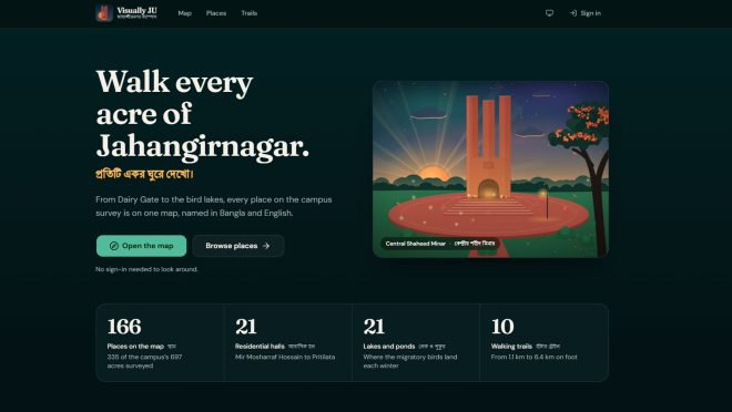
Two students of Jahangirnagar University (JU) have developed Visually JU, a digital campus map designed to help students and visitors navigate the university’s 697-acre campus in Savar.
The platform was created by Md Asif Khan, a student of the university’s 53rd batch in the Department of Computer Science and Engineering (CSE), with map data and shapefiles provided by S M Sabbir Hosen of the Department of Geography and Environment.
According to the website, Visually JU features 166 surveyed locations across the campus, with names in both Bangla and English. These include 21 residential halls, 21 lakes and ponds, and 10 walking trails.
The project began in early to mid-October after Asif struggled to find a sufficiently detailed and accessible map of the campus through existing online sources. He began developing the platform using hall data and map files prepared by Sabbir, gradually expanding it to include buildings and other locations.
Asif said the project was partly inspired by the difficulties admission candidates face navigating the campus each year, as existing maps often fail to provide clear directions.
By late October, most of the platform’s main features had been completed.
Asif credited Sabbir’s geolocation work and map data for making the project possible. He also thanked his friends’ group, Chrome, for helping with debugging, testing and quality assurance.
“There is still a lot of work to do, but I’m glad that we have reached this stage,” he said.
The platform’s features currently require users to sign in with a Google account linked to a juniv.edu email address, a restriction Asif attributed to the project’s limited resources.
With funding, the team hopes to make the features accessible to a wider audience, particularly during the admission season, and develop applications for Android and iOS devices.
Asif has also established copyright and usage restrictions for the project. The map data cannot be used commercially or reused on other platforms without his consent.