
Beyond the coast: Bangladesh’s overlooked riverine climate crisis
Beyond the coast: Bangladesh’s overlooked riverine climate crisis
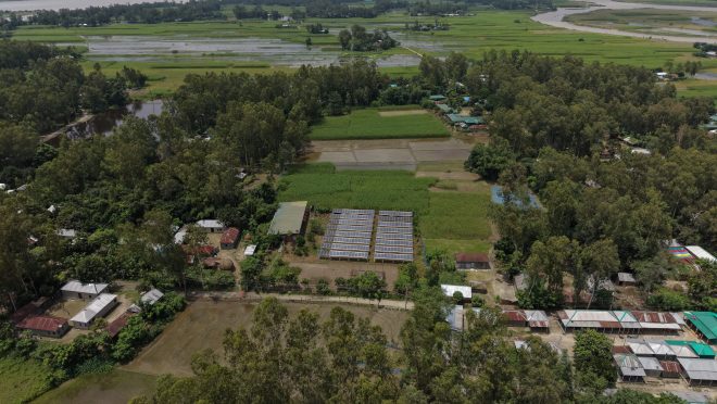
I grew up beside the Jamuna, in a household where the river was less a feature of geography than a fact of temperament. It decided when uncles moved, which cousins finished school and which did not, where the winter vegetables would be planted this year because last year’s plot no longer existed. I did not think of any of this as climate change. I thought of it as Tuesday.
It was only later, in classrooms and seminars in Dhaka discussing Bangladesh’s climate crisis, that I noticed a strange asymmetry. The Bangladesh described in those rooms had a coastline, cyclones with names, mangrove forests, a sea level that rose in centimetres you could plot on a graph. It rarely had a river that ate fifty metres of bank in a season and gave a family no warning beyond the sound of water finding a new place to be. I knew both versions of this country. Only one of them, I began to notice, had become the one we tell.
That noticing sharpened this year during an ICCCAD Youth Fellowship field visit to Goynar Potol Char in Chilmari, Kurigram, one of the riverine islands scattered along the Brahmaputra-Jamuna. What I found there was not a community waiting to be rescued but one that has spent years quietly redesigning how it lives, and it is worth saying plainly what this is not: northern Bangladesh has not been erased from the record. Researchers have published detailed vulnerability and displacement studies on Kurigram and Gaibandha chars in recent years. National newspapers, this one included, report on Kurigram’s erosion with real regularity. Bangladesh’s two major long-term planning documents, the Bangladesh Delta Plan 2100 and the more recent Mujib Climate Prosperity Plan, both independently name River Systems and Estuaries as one of the country’s principal climate hotspots, a zone spanning roughly 29 districts and more than 35,000 square kilometres of char land, riverbank and floodplain, larger than either plan’s own coastal zone designation. On paper, at least, the rivers already sit near the centre of how Bangladesh understands its own risk.
What sits less easily on paper is a fact buried in the Delta Plan’s own technical assessments: of the country’s three major rivers, net erosion is worst along the Brahmaputra-Jamuna, the river I grew up beside. It is a specific, checkable, almost startling detail, and yet I have never once heard it spoken aloud outside a hydrology paper. Compare that silence to the reach of Bangladesh’s best-known climate story, the fifty-year journey from the 1970 Cyclone Bhola disaster to a hundredfold reduction in cyclone deaths through early-warning systems and coastal shelters, a story the World Bank has told to a global audience and that Bangladesh has every right to be proud of. It is also, notably, a coastal story. When people abroad picture Bangladeshi resilience, this is very likely the picture they hold, because it is close to the only one that has travelled.
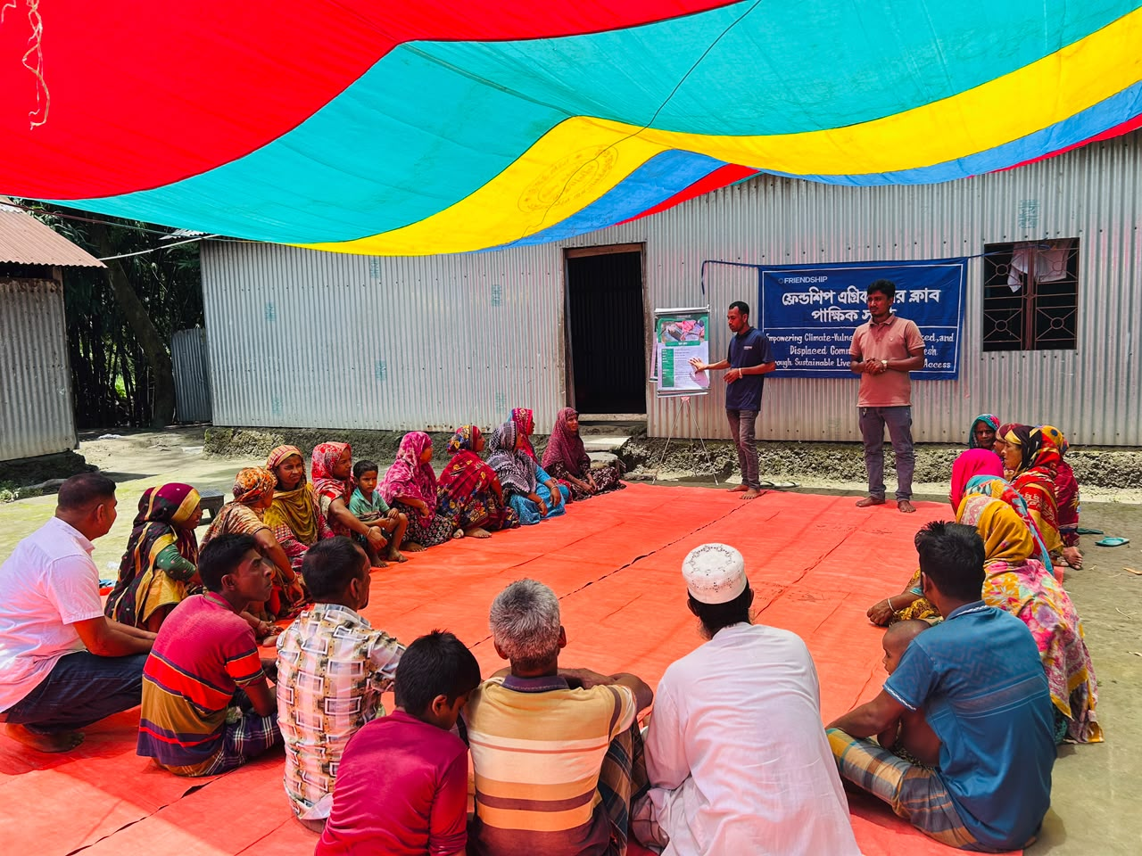
Photo: Fatema Tuz Jannat Noor
A published study of how Bangladesh’s climate crisis gets researched and reported offers a partial explanation: both media coverage and field research tend to concentrate on the country’s south-western coastal villages, the places that have, over time, become shorthand for what Bangladeshi vulnerability looks like to an outside observer. I want to be careful about what this means and what it does not. It is not evidence of neglect. It is evidence that a country’s climate story, like any story, needs someone to keep telling it, and for the northern chars, the telling has lagged behind the living.
That gap became easiest to see in Goynar Potol Char through the ordinary texture of what has been built there, not as a catalogue of infrastructure but as a record of what changes when uncertainty becomes something people design around rather than simply endure. A solar-powered fridge in a shopfront sounds like a technical detail until you learn what it replaced: a full day’s boat journey to Chilmari or Ramna and roughly two thousand taka in fare, just to keep a course of antibiotics or insulin usable. That is not an upgrade in convenience. It is a difference in whether a family delays treatment because the cost of reaching it is too high. A school built to be dismantled and moved within hours, rather than abandoned to the river, carries a similar weight once set against the national picture: disaster-linked school closures fall hardest on girls, and government enrolment data show that more than four out of five secondary students who dropped out due to disaster impacts between 2019 and 2023 were girls, with researchers repeatedly linking prolonged closures after flooding to earlier marriage. A movable school will not undo that pattern on its own. But it is, in a landscape with few defences, one of the sturdier ones available.
I watched women in the community help build a hazard calendar, a seasonal chart mapping when floods, planting and harvests overlap, and what struck me was not the tool itself but how unhesitatingly they spoke while making it, naming risks and crop cycles they had clearly tracked for years without anyone asking them to write it down before. Bag gardens lifted onto higher ground before a flood, farming plots shared among families with no land of their own, a legal aid desk untangling the ownership disputes that erosion itself creates: none of this reads as a success story so much as a record of what dignity requires when the ground itself cannot be trusted to hold still.
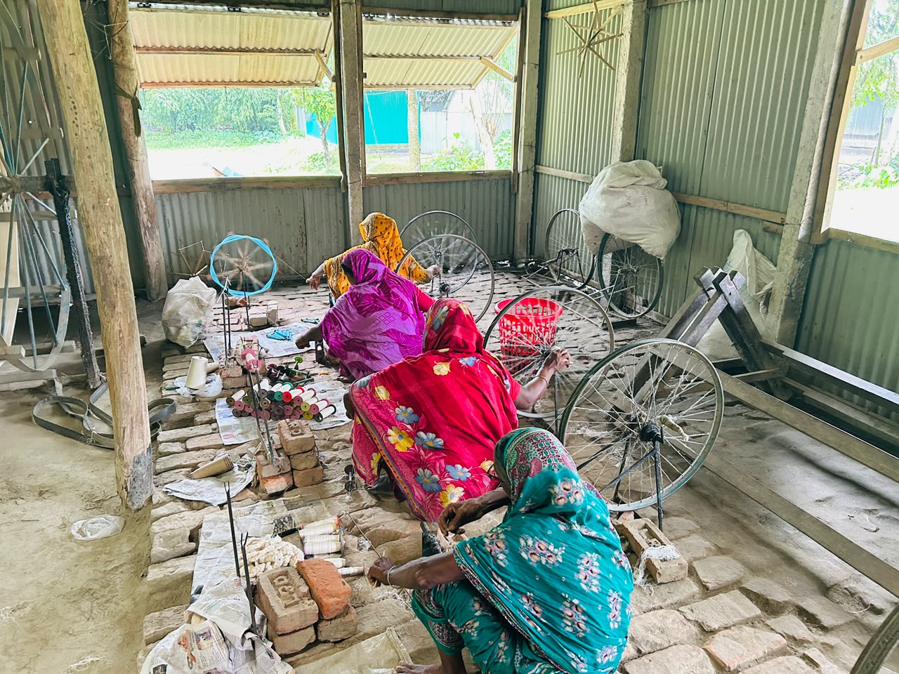
Photo: Fatema Tuz Jannat Noor
None of this argues that coastal Bangladesh receives more attention than it deserves. Its risks, rising seas, salinity and cyclones, are real and thoroughly documented, and they belong at the centre of how the country plans ahead. The IPCC’s most recent assessment projects increased flooding in both the Ganges and Brahmaputra basins together and estimates that roughly a quarter of the population could face water scarcity by 2050, a warning that implicates the whole river system, not one stretch of it. The point is not a competition between two geographies for a fixed amount of concern. It is that a country’s climate story has room for more than one river running through it, and Bangladesh’s has so far mostly had one.
Fixing that does not require new studies or new money; both already exist in reasonable measure for the river systems. It requires the smaller, steadier habit of letting an erosion statistic run alongside the adaptation happening quietly beside it, of giving a solar-lit clinic shelf and a school that packed itself up and moved the same kind of attention as a cyclone shelter, until whose experience gets to define Bangladeshi resilience is no longer decided by which coast a camera happened to be facing.
I no longer think of the char as a place defined only by what the river takes from it. I think of it as a place that has spent decades learning a fluency in impermanence the rest of the country is only beginning to notice, largely because we were rarely asked to listen. The Jamuna I grew up beside taught me to expect loss before I understood it as climate change. It has taken me this long to realise it was also teaching me what adaptation looks like when no one is watching, and that the river deciding which cousin finishes school was never just family history. It was always the story, waiting for someone to tell it as one.
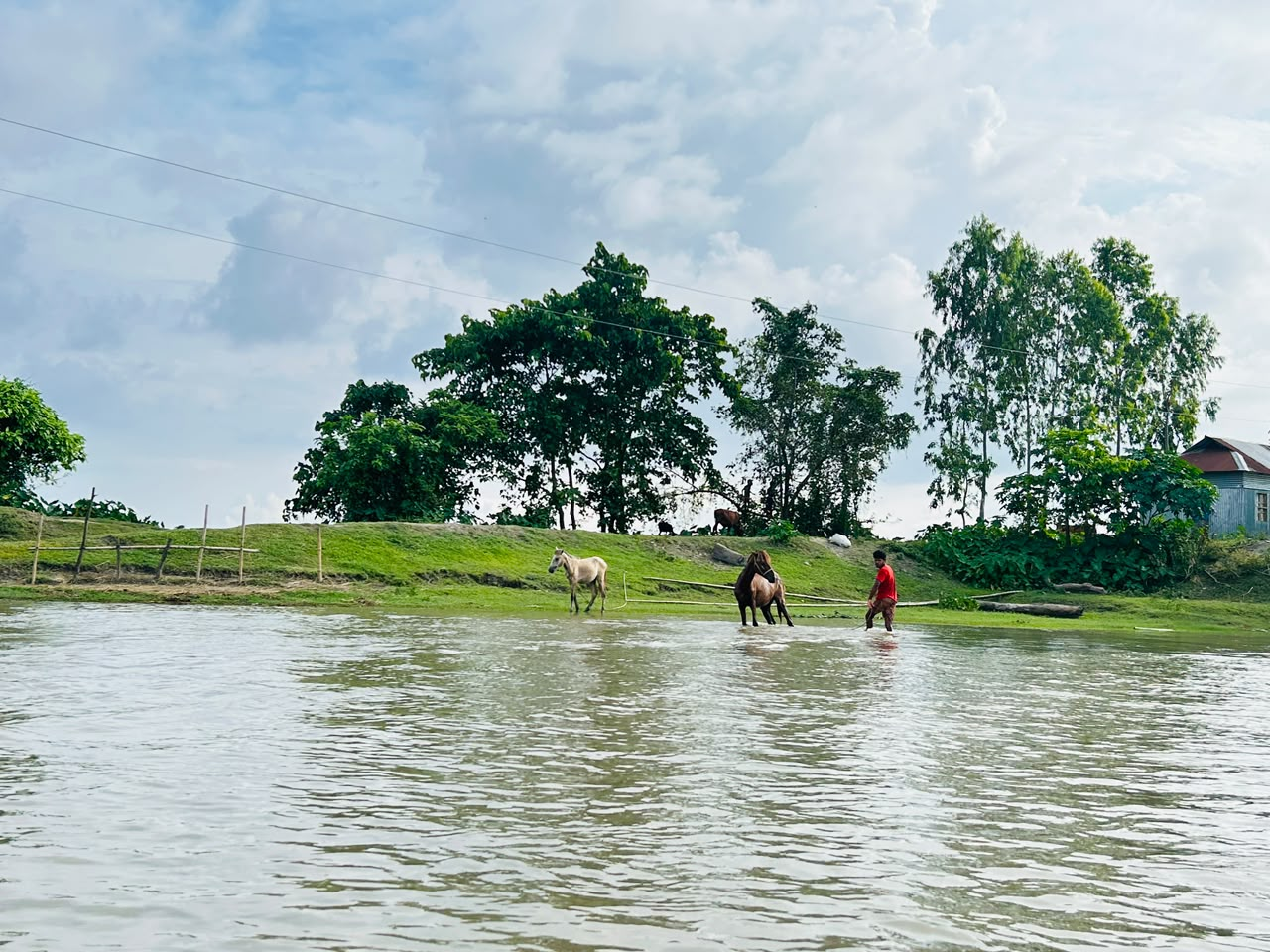
Photo: Fatema Tuz Jannat Noor